
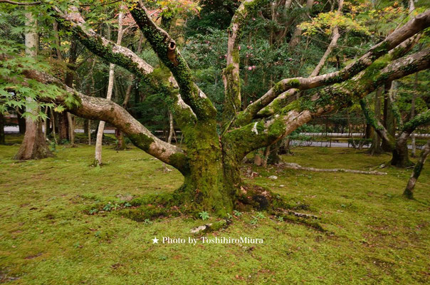
★★ 和歌山・伊勢志摩・フォトギャラリー ★★

NEW
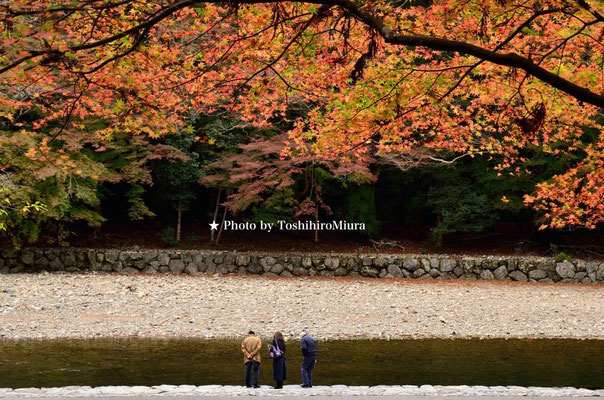
★ 伊勢神宮、内宮の彩 ★
日本の古来からの信仰の場所、伊勢神宮。
日本の神と称される場所ですね。
ここには日本の美しさ、静けさ、清らかさが宿ってます。
そのような伊勢神宮の写真をここで紹介しております。是非ご覧になってください。
三浦俊裕
The location of the belief and Ise-jingu from Japanese ancient times. It's the place called a Japanese god, isn't it? Beauty of Japan, the quiet and clear lodge here.
Such picture of Ise-jingu is being introduced here. Please see it by all means.
Toshihiro Miura.


★ 伊勢志摩の夕景の美しさ ★


丸山千枚田・水田の頃

丸山千枚田(まるやませんまいだ)は、三重県熊野市紀和町丸山地区にある白倉山(標高736m)の南西斜面を利用した棚田群。
千枚田と言われるが、実際には高低差160m(標高90-250m)の谷合に約1,340枚(7ha)の棚田がある。最も小さい田は、1枚で0.5m2しかない[2]。棚田の法面は野面積み(のづらづみ)を主とした石積みであり、西日本に多く見られる方式である。
丸山千枚田がいつ頃から存在したかは明らかではない。丸山で最初の検地が実施されたのは天正18年(1590年)のことである。関ヶ原の戦いの後、浅野幸長が紀伊に移封され、慶長6年(1601年)に検地が行われたときには既に約2,240枚の棚田があったとされる。安斎忠雄が1898年(明治31年)の測量図を推定したところ、この時の棚田は2,483枚であった。
丸山千枚田の価値を最初に見出したのは地理学者の中島峰広であり、1974年(昭和49年)に「本邦における棚田地域の地理学的研究」という論文を執筆している。棚田経営は近くの銅鉱を中心とした鉱山での労働との兼業によって維持されていたが、1978年(昭和53年)に鉱山が閉山、労働力の流出を招いた。後継者不足と高齢化、更に当時の減反政策やコメの価格低迷、機械化が難しいことなどの要因も重なり、耕作放棄が進み、1992年(平成4年)には530枚まで減少した。
この歴史的遺産を残すため、当時の紀和町の町長が1993年(平成5年)7月7日に座談会を開き、住民が棚田の復興に努力するのであれば行政として支援する旨を表明、同年8月20日に「丸山千枚田保存会」が結成された。同会は丸山地区の住民31戸が加入し、農林水産省から2004年(平成16年)度の「立ち上がる農山漁村」(交流分野)に選定された。 1994年(平成6年)には紀和町が日本初の千枚田を保存する「紀和町丸山千枚田条例」(平成6年紀和町条例第1号)を制定した。紀和町は2005年(平成17年)11月1日に熊野市と合併し地方公共団体としては消滅したが、条例は新・熊野市に引き継がれた(「熊野市丸山千枚田条例」平成17年11月1日熊野市条例第109号)。
以上 Wikiより抜粋
Maruyama thousand Hirata, terraced rice fields group using the southwest slope Shirokurayama in the Mie Prefecture Kumano
Kiwa-cho district of Maruyama (altitude 736m).
It is said that a
thousand pieces of fields, there are rice terraces (7ha) about 1,340 pieces to valley height difference of 160m (altitude 90-250m) in practice. There is only 0.5m2 with one piece of the smallest fields [2]. Is a stone masonry and masonry the main Nozura (Nozura-zumi), slope of the rice terraces is the method that is often seen in western
Japan.
It is not clear When did Maruyama thousand Hirata or were present. Land surveying of the first to have been carried out in the Maruyama is that 18 years of Tensho (1590).
It is that there was a rice terraces of about 2,240 pieces already at the time
after the Battle of Sekigahara, Asano Yukinaga is Utsurifu in Kii, land surveying was carried out in six years Keicho (1601). Where Anzai Tadao estimated the survey map of 1898 (Meiji 31 years), terraced rice fields at this time was 2,483
pieces.
Was first found in the value of Maruyama thousand pieces of field is a Nakajima MineHiro
of geographers, I'm writing a paper called "geographical study of local rice terraces in Japan" 1974 (1974). Tanada management was maintained by part-time with the labor of the mines with a focus on copper mineralization nearby, but
mine closure in 1978 (1978), and led to the outflow of labor. Aging and
successor shortage, price slump and rice acreage reduction policy at the time, factors such as that mechanization is difficult even overlap further, abandoned advances, 530 pieces was reduced in
1992 (Heisei 4 years).
The expressed intention to support administrative
order to leave this historical legacy, mayor of Kiwa town at the time held a roundtable discussion on July 7, 1993, residents as long as the effort to reconstruction of rice terraces
, "Maruyama thousand pieces of field Preservation Society" was formed on August 20 the same year. 31 units of residents Maruyama district joined, Dokai was selected "Rural rising" 2004 (2004) degree in (alternating current
field) from the Ministry of Agriculture, Forestry and Fisheries. Was enacted
Kiwa town to save a thousand pieces fields of Japan's first "Kiwa-cho, Maruyama thousand Hirata ordinance" the (Kiwa Town Ordinance No. 1, 1994) to 1994 (1994). Kiwa town ceased to exist as a local public entity merged with Kumano on
November 1, 2005, but was taken over in New Kumano Ordinance ("Kumano Maruyama thousand Hirata ordinance" in 2005 No. 109 Kumano ordinance November 1st year).
Excerpt from Wiki or more


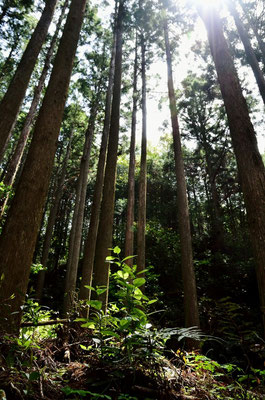
★ 熊野古道 散策 ★
熊野古道は、熊野三山(熊野本宮大社、熊野速玉大社、熊野那智大社)へと通じる参詣道の総称。紀伊半島に位置し、道は三重県、奈良県、和歌山県、大阪府に跨る。これらの多くは、2000年に「熊野参詣道」として国の史跡に指定され、2004年に「紀伊山地の霊場と参詣道」の一部としてユネスコの世界遺産(文化遺産における「遺跡および文化的景観」)として登録された。なお、その登録対象には紀伊路は含まれていない。
熊野古道(大阪では熊野かいどうといわれている)を紹介した銅版(大阪市・北浜)
このような「道」が世界遺産として登録された他の例には、「サンティアゴ・デ・コンポステーラの巡礼路」(文化遺産、スペイン)がある。道が世界遺産として登録されること自体はまれである。
熊野古道の遺構の特徴として、舗装に用いられた石畳が残っていることがある。石畳が用いられたのは、紀伊半島が日本でも有数の降雨量の多い地域だからである。また、江戸時代に紀州藩により整備された一里塚が残っている個所もある。
熊野古道の中には、国道や市街地のルートと重複していて吸収されてしまったものもある。こうしたことが生じるのには紀伊半島の地理が関係している。すなわち、紀伊半島の中央部は、際立った高山こそないものの、どこまでも続く山々と谷に覆われている。このため、古来より交通開発が困難であり、交通路に適する場所は限られている。現在もこの事情は同様であり、結果として、現代の主要な交通路は古人の拓いた道に並行し、さらには上述のように重複することになる。世界遺産に登録されたものが熊野古道の全てではないことにも留意する必要がある。これは、熊野詣それ自体の盛衰もあって正確なルートが不明になっている区間があること、歴史的な変遷から生じた派生ルートがありそのすべてが対象となっていないこと等による。なお、そうした「忘れられた」ルートを再発見しようとする地元の動きもある。
熊野周辺は、日本書紀にも登場する自然崇拝の地であった。
907年の宇多法皇の熊野行幸が最初と言われる。熊野三山への参詣が頻繁に行われるようになったきっかけは、1090年の白河上皇の熊野御幸からと言われている。白河上皇はその後あわせて9回の熊野御幸を行った。これにより京都の貴族の間に熊野詣が行われるようになった。その後、後白河上皇も33回の熊野御幸を行っている。
江戸時代に入ると、伊勢詣と並び、熊野詣は、広く庶民が行うようになったといわれている。一時は、熊野付近の旅籠に1日で800人の宿泊が記録されたこともあったようだ。
1906年(明治39年)末に布告された「神社合祀令」により熊野古道周辺の神社の数は激減。熊野詣の風習も殆どなくなってしまった。
熊野古道自体は、大正から昭和にかけて国道が整備されるまで、周囲の生活道路として使用されつづけた。
以上Wikiより抜粋
Kumano Kodo is a general term for pilgrimage road leading Miyama Kumano (Kumano Hongu Taisha, Kumano
fast ball Taisha, Kumano Nachi Taisha) to. It is located in the Kii Peninsula, across the road Mie, Nara,
Wakayama Prefecture, Osaka Prefecture. It is
designated as a national historic site as "Kumano Pilgrimage" in 2000, many of these, and cultural "remains in (Cultural Heritage World Heritage Site by UNESCO as part of the" Sacred Sites and
Pilgrimage of the Kii Mountain Range "in 2004 It was registered as a landscape "). The Kii channel is not included in the registration target.
(In Osaka It is said that the Kumano crabapple) Kumano Kodo copperplate, which was
introduced a (Osaka Kitahama)
Examples of other such "road" is registered as a World Heritage Site, a
"pilgrimage of Santiago de Compostela" (cultural heritage, Spain). by itself, the way is
registered as a World Heritage Site is rare.
Sometimes cobbled as a feature of the ruins of the Kumano Kodo, was used for the paving
remains. Stone pavement that used to, Kii Peninsula is because a lot of local rainfall eminent in
Japan. There are also places where milestone that has been developed by the Kishu
clan in the Edo era remains.
Some of the Kumano Kodo, some of which had been absorbed not overlap with the root of the
national highway and city. Geography of the Kii Peninsula is concerned these things are to occur.
That is, there is no alpine what you stand out, but the central part of the Kii Peninsula, is
covered in the valley and mountains uninterrupted. Therefore, the traffic development is difficult since ancient times, locations
suitable for the traffic channel is limited. This situation is similar also present, so that as a result, a
main traffic path of modern parallel to the road pioneered the ancient people, overlapping as described above further. It should be
noted also that what has been a World Heritage Site is not all, of the Kumano Kodo. This is because there is a section in which exact route is in the unknown there also rise and fall of
Kumanomou itself mainly a result of all of which is not the subject there is a derived route resulting from the transition historic. There is also a movement of local to try to re-discover "forgotten" the route that was so.
Kumano around, was a land of nature worship that also appears in Chronicles.
I is said Kumano royal visit of Pope Uda 907 years the first. How did the pilgrimage to Kumano three mountains came to be done frequently, is said to be from Miyuki
Kumano of Shirakawa of 1090. Shirakawa was Miyuki Kumano nine times together then. Kumanomou came to be made during the nobility of Kyoto by this. Then, post-Shirakawa also have done Kumano Miyuki 33 times.
Once in the Edo period, it is said Along with Mai Ise, is Kumanomou, ordinary people and got to do widely. Temporary, seems there was also that accommodation of 800 people was recorded in one day in the tavern near
Kumano.
Number of shrines of Kumano Kodo around depleted was decreed in 1906 by the end
of "shrine enshrined Ordinance". Customs Kumanomou also gone almost.
National road until the maintenance Showa from Taisho, Kumano Kodo itself, continued to be used as a community road
surrounding.


Nanki・Ise-Sima Photo Gallery

Ise-Shima, Mie Prefecture, which is located in
the southern part of the resort where you can enjoy a superb view very mild. Would be able to be seen to be one of
history such as the Ise Shrine in Japan, the appearance of
the original Japanese there.
We introduce shooting in Ise Shima Nanki that.
Photo By Homi.Siratori


● 著作権法に基づく表記 ●
(重要!!)
注)。掲載の写真は三浦俊裕撮影の元での著作権管理の物となります。当方の許可なく無断での掲載、転載を行わないよう宜しくお願いいたします。
(一部白鳥保美記載の物も含む)
Note). Shall become the property of the photographs in management under Toshihiro Miura shooting.
Thank you so you do not post without permission, a reprint without permission of us.
★サンダンスリゾート ユタ★
Mountain Resort

米国ペンシルバニア州
政府日本事務所

Copyright (c) 2012 - 2020 写真家三浦俊裕HP All Rights Reserved.